Appalachian Trail - Atkins/I-81 to US-52 (Bland VA)
Saturday - March 28, 2026
Stayed the night at a hotel in Dublin, VA. Made it to Weary Feet Hostel about 8L45a. Jukebox picked me up about 9:45a to shuttle me to the start.
Got to I-81 about 10:30a.
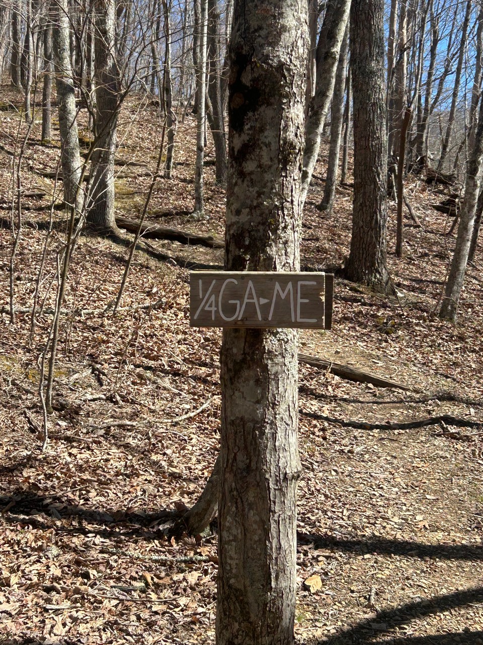
Chilly and sunny. A bit of wind which stung a bit at times. Crossed by the 1/4 Trail Marker. Not sure if they update the post each year but it has to be close to the 1/4 mark. Probably not the mark for me because I am still missing a decent size section south of here.
My shoes started to fail (I was hoping to finish this hike with them, but no luck). When I got to the top of a ridge I called Marion Outdoors and arranged a shuttle into town. Bryan met me at the gap and got me into Marion. Staff was great and got me setup with some new boots. Decided to stay in their hostel for the hight.
Dinner was next door at Macado's. I haven't eaten at oen of these in many years.
In bed, an actual bed, by 8:30p where I am writing up my notes and doing some reading.
I have a shuttle at 7:30a to head back to trail with my new boots.
Start day one at I-81 - MM 546.3 End day one at VA-610 - MM 556.0
9.7 miles today.
Sunday - March 29, 2026
Bunny picked me up just before 7:30a and gave me fun facts on the sights and area as we drove to the trail head. She is a legend around here.
Made it to the trail head about 8:10a where I connected my foot stepsand continued my trek north. Crossed over VA-42 where the local hostel had left soem plastic Easter eggs with a piece of candy as hikers approach the road crossing. Nice treat.
The weather is basically perfect. Cool, sunny and not very much wind.
Made it to Knot Maul shelter (MM 560.7) about 10:40a. Boots seem good so far.
Made it to Lick Creak (MM 564.1) about 1:00p. Saw my first two hikers on trail at the crossing. This is my first real river crossing. I didn't bring Crocs/camp shoes so I did it barefoot. It was a bit deeper than my boots would be. Water was cold, but not too bad.
Long tough climb to end the day at Chestnut Knob Shelter (MM 570.1)
Beautiful view of the vally from this old firewatch cabin.
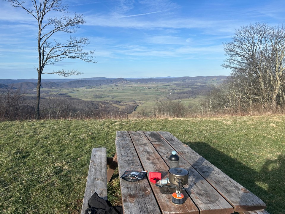
So far four others at the shelter with me.
14.1 miles today/23.8 miles total
Monday - March 30, 2026
Up about 6 this morning. There were six in the shelter and one was heading out before sunup. Turns out one of the gents in the hostel came in after dark and caught up to me.
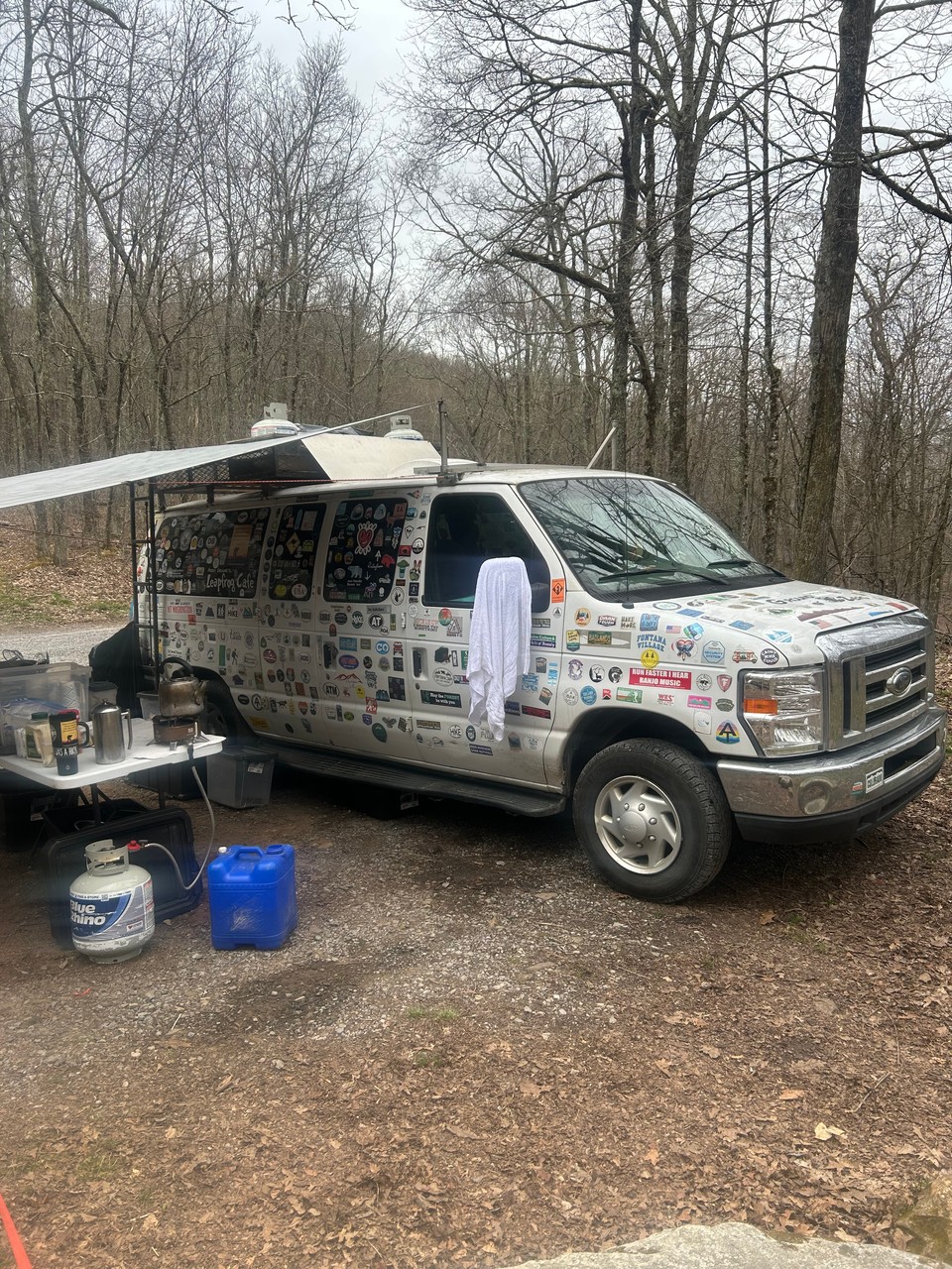
Tough decent and ridge walk to start today. But I heard Fresh Ground and the Leapfrog Cafe were at the upcoming road crossing and that was good motivation. Fresh Ground and his cafe have become a staple on the trail in the last few years and I am very glad to have been met and fed by him.
My next waypoint was Jenkins Shelter 4.5 miles past the road crossing. I walked right by it and didn’t really want to backtrack.
Next and final waypoint for today was Laurel Creek/VA 615 (MM 585.2)
Got there about 4:30 and found a good campsite right next to the creek.
No one else here yet but it is a couple of hours before sunset.
Miles today 15.1/total 38.9
Tuesday - March 31, 2026
Broke camp about 7:20. Garmin watch told me I had a decent nights sleep but I feel pretty tight.
Decent climb up out of Laurel Creek with some vistas of the valley below.
Started to hear traffic about 6 miles in so I knew I was close to I-77.
Made it to Brushy Mountain Outpost just before 11. Got a burger which I had a hard time eating.
With some weather coming in tonight and my lack of energy from not really eating I decided to call a shuttle and end here for the spring hike.
Overall this was a successful hike. I didn’t quite go as far as I hoped but my plan was a bit ambitious.
Miles today 6.9/miles total 45.8